Well, where do I begin?
This first lab has opened my eyes to the importance of file management and organization.
There were many steps at which I felt like I had missed something vital and went back to read the Previous steps only to learn that I needed to start back at the beginning. I think I will be asking a few questions as to what some people thought certain questions or steps meant in the ArcGIS Pro Overview Orientation because some areas had me re-reading it multiple times in order to settle on a best interpretation.
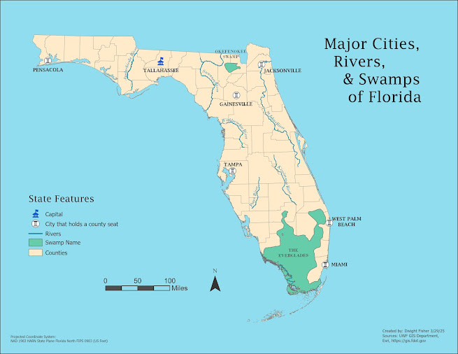
I had some issues with the Layout step and getting the map orientation right. No matter what I did the map would not center to the page. I either had to nudge the map over once or had to start back at the ANSI map view in and get it perfectly centered and zoomed out enough for it to work when the layout was created.
I almost missed the step of exporting the map extent as a Jpeg. I was a little confused however because the Orientation document says to save either as a .jpeg or .png file, but when I went to submit the assignment, it specifically says to upload the "Jpeg" file.
Luckily I chose Jpeg to begin with.
Unfortunately I created this blog post after submitting my assignment (20 minutes or so) so I may see if I can resubmit it with the Blogger link included.
Overall, once I was able to completely focus on the assignment I made good progress within a couple of hours. I think at this point I've spent as much time double checking and triple checking my work as I did actually doing it.
Hopefully that dynamic will drastically change in the coming weeks.
ArcGIS Pro did freeze up on me near the end of my work which caused me to contemplate on just installing it locally on my computer. Seeing how I built my computer last year to run anything and everything, it would make the most sense. Intel 13700k, 64gb of ddr5 7200mhz Ram, Rtx 4090 24gig GPU. It would be cool to see it run ArcGIS pro.


Comments
Post a Comment