Module 3
Using ERDAS Imagine
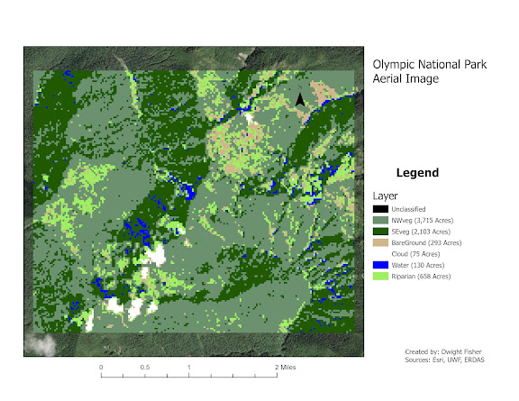
This module was the first time using another computer program other than Arc GIS Pro. There was plenty to learn but thankfully the lab was not as time consuming nor labor intensive as Lab 2.
This module was more of a hands on experience to gain insight into what working with Raster Data is really all about.
I've been so used to working with Vector Data in the form of feature class shape files that it was about time to see what raster was all about.
In this module there were quite a few areas that did not give directions as to how to perform certain tasks. A couple of them I ended up passing such as converting the Hydro_00 Vector file into a Raster Image. I attempted several times to use the conversion tool in the data management tool bar but to no avail.
I can see how ERDAS can be extremely useful in analyzing data that has large amounts of information spread through out the Image or Images you're working with. With the ability to have multiple layers for one image or vice versa, it is an ability that Arc GIS pro does no have.
I think the thing that stuck with me is the Spatial scale and the size of pixels in Raster data and how much pixel density and quantity can affect analysis.
The ability to target and group features by their attributes is pretty amazing overall.


Comments
Post a Comment